Gulf
Gulf ecosystems, such as the Gulf of Mexico, support a diverse array of marine life, though the specific composition of these communities is often influenced…
What types of marine life are commonly found in gulf ecosystems?
Gulf ecosystems, such as the Gulf of Mexico, support a diverse array of marine life, though the specific composition of these communities is often influenced by local environmental factors like salinity, water depth, and human activity.12
Commonly found marine life includes:
- Fish: The waters support large populations of fish, particularly along the continental shelf. Commercially significant species include red snapper, flounder, mullet, and menhaden.3
- Invertebrates: Crustaceans and mollusks are abundant, with shrimp, oysters, and crabs serving as key species for both the ecosystem and commercial fisheries.31
- Birds: Coastal areas are vital habitats for waterfowl and seabirds, including pelicans, noddies, and boobies.3
- Marine Mammals and Reptiles: While marine mammal populations are generally limited, the Caribbean manatee is a notable inhabitant. Various species of sea turtles also utilize these waters and coastal nesting sites.34
- Microorganisms and Coral: The food web relies on microorganisms like rotifers, while coral reefs provide essential structural habitats.4
Human activities, including pollution and offshore drilling, have significantly impacted these populations, leading to habitat loss and mortality events.42
What is the geological definition of a gulf, and how does it differ from other coastal features?
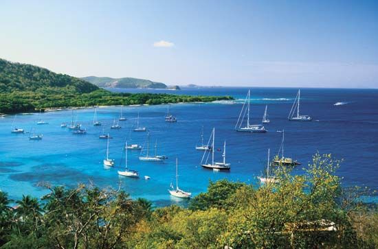
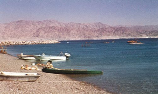
Geologically, a gulf is defined as any large coastal indentation or a reentrant of an ocean or sea that extends into the land. These features are connected to the open ocean by one or more straits. Their physical characteristics—including shape, depth, and bottom topography—are highly diverse and are determined by the specific geologic structure and development of the region.56
Differences from Other Coastal Features
The nomenclature for coastal indentations is often inconsistent, leading to significant overlap between a gulf and other features.6
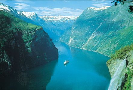
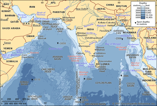
- Bays and Similar Features: While a gulf is generally considered a large indentation, the term is often used interchangeably with bay, bight, firth, sound, and fjord bight, firth, sound, and fjord. Many smaller features are labeled as bays, while some massive bodies of water, such as the Bay of Bengal, are technically gulfs.76
- Seas: The distinction between a gulf and a sea is also imprecise. Some bodies of water labeled as “seas,” such as the Sea of Azov, are geologically classified as gulfs because they function as extensions of larger oceanic basins.6
- Estuaries: Unlike a gulf, which is defined primarily by its indentation into the coastline, an estuary is a specific environment where freshwater discharge meets marine water, often formed by drowned river valleys or glacial erosion.7
How are gulfs formed through geological processes?
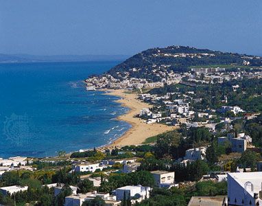
Gulfs are formed through a variety of complex geological processes that shape the Earth’s coastlines. Their development is primarily driven by the interaction between tectonic activity, erosion, and changes in sea level over geological time.25
Key Geological Formation Processes
- Tectonic Activity: Many deep, angular gulfs are created by tectonic movements, such as faulting, fracturing, and rifting. For example, the Gulf of California was formed by parallel fractures that created a deep, narrow basin.28
- Erosion: Gulfs can originate from the erosion of coastal landforms during periods of lower sea level. As sea levels rose, these previously carved troughs and river valleys were flooded by marine waters. This process is responsible for the formation of many long, narrow arms and fjord-like features.25
- Subsidence and Downfaulting: Broad local subsidence or the downfaulting of coastal areas can create large basins that eventually become gulfs, as seen in the development of various coastal indentations.5
- Glacial Influence: During the Pleistocene Epoch, fluctuating sea levels caused by glaciations repeatedly exposed and submerged continental shelves, finalizing the shapes of many shelf-based gulfs.58
The resulting morphology—whether a simple, shallow basin or a deep, complex trough—depends on the local bedrock resistance and the specific history of deformation in the region.28
What are some of the largest and most well-known gulfs in the world?
Several of the world’s largest and most significant gulfs serve as vital hubs for international trade, natural resources, and ecological diversity. Because the nomenclature for coastal indentations is often inconsistent, many of these features are categorized as gulfs despite varying sizes and geological origins.
Notable Global Gulfs
- Bay of Bengal: Despite its name, this is the largest gulf in the world, covering a surface area of approximately 2,172,000 square km (838,600 square miles). It is a major body of water in the northeastern Indian Ocean.
- Gulf of Mexico: A massive basin bordered by North America, it is renowned for its significant oil and natural gas reserves located within its continental shelf and slope. Its deepest point, the Sigsbee Deep, reaches 17,070 feet (5,203 meters) below sea level.
- Gulf of Guinea: Located off the western coast of Africa, this gulf is notable for being the deepest in the world, with a maximum depth of 6,363 meters (20,876 feet). It is also geologically significant for providing evidence of continental drift.
- Persian Gulf: A critical waterway for global energy, this region holds nearly three-fifths of the world’s estimated proven oil reserves and about one-third of its natural gas reserves.
- Gulf of California: An inlet of the Pacific Ocean, this gulf is a product of complex tectonic activity, specifically the movement of the San Andreas Fault system, which is slowly separating the Baja California peninsula from the Mexican mainland.
- Gulf of St. Lawrence: Serving as a gateway to the North American interior, this body of water is a complex relief phenomenon formed by submerged portions of the Appalachian Mountains and the Canadian Shield.
Sources
- Gulf of Mexico / Gulf of America - Plants and animals — Encyclopædia Britannica
- gulf - Factors that affect the characteristics of gulfs — Encyclopædia Britannica
- Deepwater Horizon oil spill - Environmental costs — Encyclopædia Britannica
- Gulf of Mexico / Gulf of America - Study and the impact of human activity — Encyclopædia Britannica
- gulf - Topographic characteristics — Encyclopædia Britannica
- gulf — Merriam-Webster
- gulf — Encyclopædia Britannica
- estuary - Geology and geomorphology — Encyclopædia Britannica
- gulf — Merriam-Webster
- coastal landforms - Deltas — Encyclopædia Britannica
- gulf - Classification of gulfs — Encyclopædia Britannica
- coastal landforms - Factors and forces in the formation of coastal features — Encyclopædia Britannica
- coastal landforms - Waves — Encyclopædia Britannica
- Gulf of Guinea — Encyclopædia Britannica
- Gulf of California — Encyclopædia Britannica
- Gulf of Saint Lawrence — Encyclopædia Britannica
- Persian Gulf: Top Questions — Encyclopædia Britannica
- Why Is It Called the Persian Gulf? — Encyclopædia Britannica
- Gulf of Mexico / Gulf of America - Physiography and geology — Encyclopædia Britannica
- St. Lawrence River - Physiography — Encyclopædia Britannica
Published on · 4 min read