Saint Croix River
There are two distinct rivers in North America known as the Saint Croix River.
What is Saint Croix River?
There are two distinct rivers in North America known as the Saint Croix River.
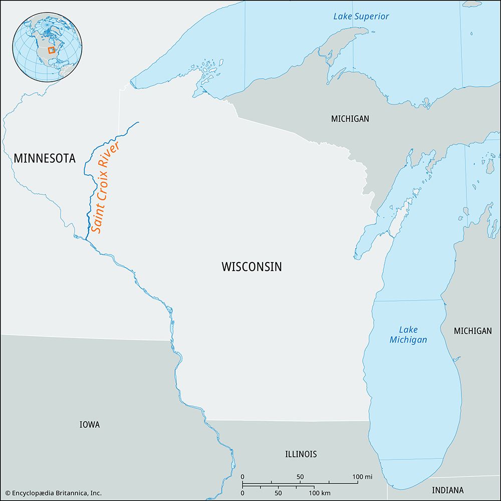
The Saint Croix River in the U.S. Midwest is a 164-mile tributary of the Mississippi River. Rising in Wisconsin, it forms the border between Wisconsin and Minnesota for 130 miles. It is noted for its scenic beauty, particularly at Interstate Park, and supports hydroelectric power generation for the Minneapolis-St. Paul area.1
The Saint Croix River in the Northeast is a 75-mile river that forms the international boundary between Maine and New Brunswick, Canada. It flows from the Chiputneticook Lakes into Passamaquoddy Bay. Historically significant for the lumber industry, it was named by Jacques Cartier and later explored by Samuel de Champlain, who attempted to establish a colony at its mouth.2
How does the Mississippi River system work?
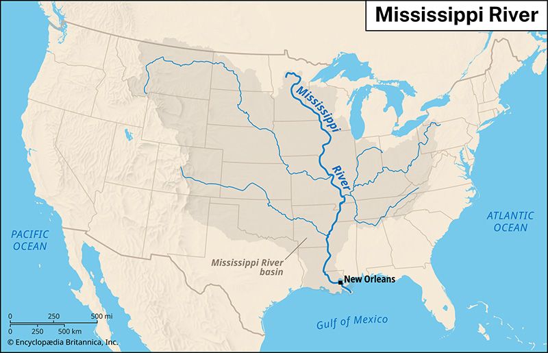
The Mississippi River system functions as a vast, interconnected drainage network that acts like a funnel, collecting water and sediment from much of the North American midcontinent and depositing them into the Gulf of Mexico.3
Drainage and Tributaries
The system is fed by three primary contributory areas:
- Western Tributaries: Rivers such as the Missouri, Arkansas, and Platte drain the Great Plains. These rivers carry significant silt loads and often exhibit irregular flow regimes.34
- Eastern Tributaries: Rivers like the Ohio and Tennessee drain the Appalachian Mountains. The Ohio is particularly critical, often providing more than three-fifths of the water in the lower Mississippi during peak flow.34
- Upper Mississippi: This section is shaped by glacial history, with its tributaries tracing former sluiceways created by melting ice sheets.3
Flood Control and Management
To manage the river’s powerful hydrology, the U.S. Army Corps of Engineers maintains an integrated system of levees, dams, reservoirs, and spillways. While these structures stabilize the channel for navigation and protect against smaller floods, major events like the 1993 and 2011 floods have demonstrated that total control is not always possible. Consequently, modern management increasingly emphasizes “living with the river” by limiting development on floodplains to allow for natural flooding.54
What is the significance of the Bay of Fundy?
The Bay of Fundy, located between the Canadian provinces of New Brunswick and Nova Scotia, is globally significant primarily for its extreme tidal activity. It experiences the highest tides in the world, with rises reaching up to 70 feet (21 meters) in certain areas.78
The bay’s significance is defined by several key factors:
- Hydrological Power: The immense volume of water moving through the bay—approximately 70 billion cubic feet during each tidal cycle—has long made it a focus for potential hydroelectric development. However, significant engineering challenges, high costs, and environmental concerns have historically hindered large-scale implementation.7
- Geological and Ecological Features: The bay is characterized by steep bedrock cliffs and unique coastal formations. The rapid tidal surges create phenomena such as “reversing falls” at the Saint John River and tidal bores on the Petitcodiac River.7
- Historical and Cultural Impact: The region’s deepwater harbors supported a thriving 19th and early 20th-century economy built on lumbering, shipping, and shipbuilding. Today, the area is also recognized for its natural beauty, preserved in part by Fundy National Park.7
Who were Samuel de Champlain and Jacques Cartier?
Jacques Cartier and Samuel de Champlain were pivotal figures in the establishment of French claims in North America.
Jacques Cartier
A French mariner, Cartier conducted three major voyages (1534, 1535, and 1541–42) that laid the foundation for New France. He was the first European to navigate the Saint Lawrence River, exploring the Gulf of St. Lawrence and visiting sites near modern-day Quebec and Montreal. While he is credited with naming Canada, his attempts to establish a permanent colony and find precious minerals were unsuccessful, and his reputation was marred by his poor treatment of local First Nations peoples.1011
Samuel de Champlain
Often called the “Father of New France,” Champlain was instrumental in the actual occupation and consolidation of French colonies. After early efforts in Acadia, he founded Quebec in 1608 to serve as a hub for the fur trade. Champlain was a dedicated explorer who mapped the Ottawa River and the Great Lakes, securing the mid-continent for French interests through strategic alliances with the Algonquin and Huron against the Iroquois Confederacy.1213
Sources
- Saint Croix River — Encyclopædia Britannica
- Saint Croix River — Encyclopædia Britannica
- United States - The Eastern systems — Encyclopædia Britannica
- Mississippi River - Physiography — Encyclopædia Britannica
- Mississippi River - Flood control — Encyclopædia Britannica
- Mississippi River - Hydrology — Encyclopædia Britannica
- Bay of Fundy — Encyclopædia Britannica
- Fundy, Bay of — Merriam-Webster
- Fundy National Park — Encyclopædia Britannica
- Samuel de Champlain: Top Questions — Encyclopædia Britannica
- Canada - Jacques Cartier — Encyclopædia Britannica
- Canada - Samuel de Champlain — Encyclopædia Britannica
- Jacques Cartier — Encyclopædia Britannica
Published on · 3 min read