Timan Ridge
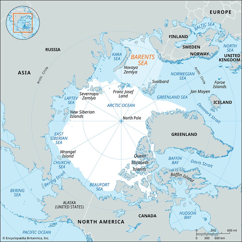
The Timan Ridge is a formation of high land located in northeastern European Russia. It stretches approximately 470 miles (750 km) in a generally north-south…
What is Timan Ridge?
The Timan Ridge is a formation of high land located in northeastern European Russia. It stretches approximately 470 miles (750 km) in a generally north-south orientation, extending from the Barents Sea to the source of the Vychegda River.1
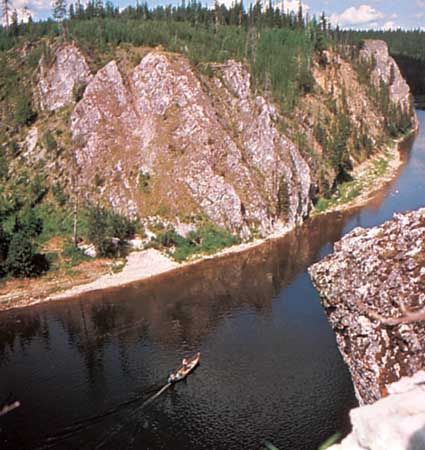
Geologically, the ridge was created by an upwarping of the underlying Russian Platform and is composed of very ancient schists and other materials. The topography of the ridge varies by region:1
- Northern section: This area is higher and features four distinct hilly massifs, reaching elevations of up to 1,519 feet (463 m).1
- Southern section: This portion is characterized by a plateau-like landscape.1
What is the significance of the Timan-Pechora Basin for natural resources?
The Pechora River basin is a region of significant economic importance due to its vast natural resource wealth. The area contains substantial deposits of coal, petroleum, and natural gas, which serve as critical energy assets for the region.4
In addition to these mineral and fuel resources, the basin supports significant industrial activity related to the extraction and transport of timber, which is moved via the river system.4
How do geological upwarps like the Timan Ridge change the landscape over time?
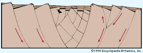
Geological upwarps, such as the Timan Ridge, are tectonic landforms created by the vertical uplift of the Earth’s crust. These processes act as “builders,” raising rock material to form elevated features like mountains and plateaus.5
Over time, the landscape is shaped by a continuous interplay between these tectonic forces and erosion:
- Tectonic Construction: Upwarping occurs through mechanisms like crustal folding, thermal expansion, or the overthrusting of rock blocks. These processes create the initial differences in elevation that define the region’s macrostructure.56
- Erosional Sculpting: Once uplifted, the land is immediately subjected to denudation by water, wind, and ice. While tectonic processes build the structure, erosion acts to reduce elevation differences, molding the surface into its specific profile.57
- Persistence: If the rate of erosion is not excessively rapid, features created by upwarping can persist for hundreds of millions of years, even long after the original tectonic activity has ceased.5
What are some other major mountain ranges or ridges in Russia?
Russia features a vast and diverse array of mountain systems, ranging from the historic boundary of the Urals to the complex volcanic chains of the Far East. Here are some of the most significant ranges and ridges:
- Ural Mountains: Stretching 1,550 miles, this range serves as the traditional physiographic boundary between Europe and Asia. It is a rugged, mineral-rich spine that extends northward into the Pay-Khoy Ridge and the Novaya Zemlya archipelago.1112
- Caucasus Mountains: Located between the Black and Caspian seas, this system includes the Greater Caucasus and Lesser Caucasus. It contains the highest peak in Russia, Mount Elbrus, which reaches 18,510 feet.13
- Altai Mountains: A complex system in Central Asia that reaches elevations of 14,783 feet at Mount Belukha. It serves as a major relief region along the borders with Kazakhstan and Mongolia.1415
- Sayan Mountains: Situated east of the Altai, this V-shaped system consists of the Western and Eastern Sayan ranges, which enclose the high Tyva Basin.15
- Chersky Range: Extending over 900 miles in northeastern Siberia, this range is part of an extensive mountain system and features peaks reaching over 10,000 feet, such as Mount Pobeda.1516
- Verkhoyansk Mountains: Running parallel to the lower Lena River, this massive arc of mountains reaches heights of 7,838 feet.1517
- Sikhote-Alin: A mountain complex in the Russian Far East that fronts the Sea of Japan, known for its dense forests and mineral resources.1518
Sources
- Timan Ridge — Encyclopædia Britannica
- Taymyr Peninsula — Encyclopædia Britannica
- Asia - Paleozoic events in the Tethysides — Encyclopædia Britannica
- Pechora River — Encyclopædia Britannica
- tectonic landform — Encyclopædia Britannica
- river - Valley evolution — Encyclopædia Britannica
- upwarp — Merriam-Webster
- soil - Erosive processes — Encyclopædia Britannica
- erosion — Encyclopædia Britannica
- diastrophism — Encyclopædia Britannica
- Ural Mountains — Encyclopædia Britannica
- Altai Mountains — Encyclopædia Britannica
- Russia - The mountains of the south and east — Encyclopædia Britannica
- Russia - The Ural Mountains — Encyclopædia Britannica
- Verkhoyansk Mountains — Encyclopædia Britannica
- Caucasus — Encyclopædia Britannica
- Caucasus - Geology of Caucasus — Encyclopædia Britannica
- Chersky Range — Encyclopædia Britannica
- Sikhote-Alin — Encyclopædia Britannica
Published on · 3 min read