Zomba Massif
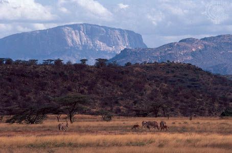
The Zomba Massif is an isolated mountain mass composed of syenite that rises from the Shire Highlands in southern Malawi. Covering approximately 50 square…
What is Zomba Massif?
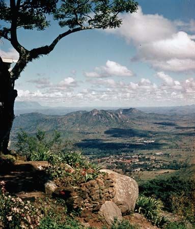
The Zomba Massif is an isolated mountain mass composed of syenite that rises from the Shire Highlands in southern Malawi. Covering approximately 50 square miles (130 square km), it reaches an elevation of 6,846 feet (2,087 meters) at Zomba Peak.12
The massif is divided by the Domasi River valley into two distinct sections: the Zomba Plateau to the south and Malosa Mountain to the north. Its landscape features sheer scarps that drop significantly to the surrounding plains, and its western wall forms part of the boundary for the Shire rift valley.1
The region is a popular tourist destination, offering a network of walking trails, hiking, and trout fishing. The plateau’s tabular surface, situated at 6,000 feet (1,830 meters), is utilized for softwood afforestation and mountain resort development. The city of Zomba, the former capital of Malawi, lies on the lower slopes of the mountain.13
What is the East African Rift System?
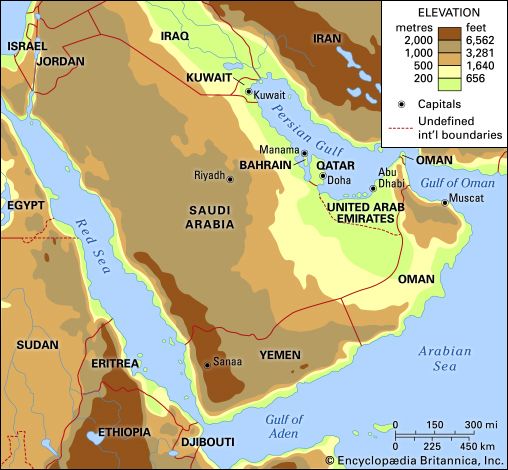
The East African Rift System is one of the most extensive rift structures on Earth, stretching approximately 4,000 miles (6,400 km) from Jordan in the north to Mozambique in the south. Averaging 30–40 miles (48–64 km) in width, this system has been forming for roughly 30 million years as the African and Arabian plates have separated.](https://www.britannica.com/place/Arabia-peninsula-Asia) have separated.6
The system is divided into two primary branches:
- Eastern Rift Valley: Often called the Great Rift Valley, this main branch runs from the Jordan River and Dead Sea southward through the Red Sea, Ethiopia, and Kenya, eventually reaching the Indian Ocean in Mozambique.6
- Western Rift Valley: This branch arcs northward from Lake Nyasa and includes several deep, fjordlike lakes, such as Lake Tanganyika, Lake Kivu, and Lake Albert.6
The rift is characterized by significant volcanism, which has produced prominent massifs like Kilimanjaro and Mount Kenya. The adjacent plateaus typically drop 2,000 to 3,000 feet to the valley floor, though some escarpments exceed 9,000 feet.6
How does the Mulanje Massif compare to the Zomba Massif?
The Mulanje and Zomba massifs are both prominent, isolated syenite mountains located in the Shire Highlands of southern Malawi. While they share a similar geological composition, they differ significantly in scale and elevation.219
Key Comparisons
Feature
Mulanje Massif
Zomba Massif
Maximum Elevation
9,849 feet (3,002 meters)
6,846 feet (2,087 meters)
Status
Highest point in Malawi
Notable highland peak
Structure
Rectangular mass with deep clefts and crater-like hollows
Divided by the Domasi River into two sections (Zomba Plateau and Malosa Mountain)
Economic/Land Use
Tea plantations, bauxite deposits, and
Mulanje cedar
forestry
Softwood afforestation and mountain resort development
Both massifs rise abruptly from the surrounding landscape and overlook the Lake Chilwa–Phalombe plain to the east. While Zomba is well-known for its accessible walking trails and tourism infrastructure, Mulanje is characterized by its rugged, difficult terrain and unique botanical features, such as its dense canopy of broad-leaved trees and cedar stands.291
What is the historical significance of Zomba as a former capital?
Zomba holds significant historical importance as the administrative heart of Malawi for nearly a century. Established in 1885 as a planters’ settlement, it became the center for the administration of the British Central African Protectorate (later Nyasaland) in 1891.3
Following independence, Zomba served as the capital of Malawi until 1975, when the seat of government was moved to Lilongwe. Several landmarks from this era remain, including the 1887 Residency—originally built to provide protection from slave traders—and the Parliament Building, which hosted legislative sessions until 1994.3
The city’s character underwent a major transition in 1974 with the establishment of Chancellor College, a constituent campus of the University of Malawi, which shifted its identity from a primary government center to a prominent university town. Today, while no longer the capital, Zomba remains a vital regional hub for agriculture and education.3
Sources
- Zomba Massif — Encyclopædia Britannica
- Malawi - Relief — Encyclopædia Britannica
- Zomba — Encyclopædia Britannica
- Zambia - Plant and animal life — Encyclopædia Britannica
- Mafinga Hills — Encyclopædia Britannica
- East African Rift System — Encyclopædia Britannica
- East African lakes - Geology, climate, and hydrology — Encyclopædia Britannica
- Rift Valley — Encyclopædia Britannica
- Mulanje Mountains — Encyclopædia Britannica
- Lilongwe — Encyclopædia Britannica
- Malawi - The Banda regime, 1963–94 — Encyclopædia Britannica
- Malawi: Country Facts — Encyclopædia Britannica
- History of Malawi - Colonial rule — Encyclopædia Britannica
Published on · 3 min read