Guadalupe Peak
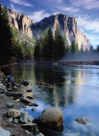
Guadalupe Peak is the highest point in Texas, reaching an elevation of 8,749 feet (2,667 meters). Located in Culberson County, approximately 100 miles east…
What is Guadalupe Peak?
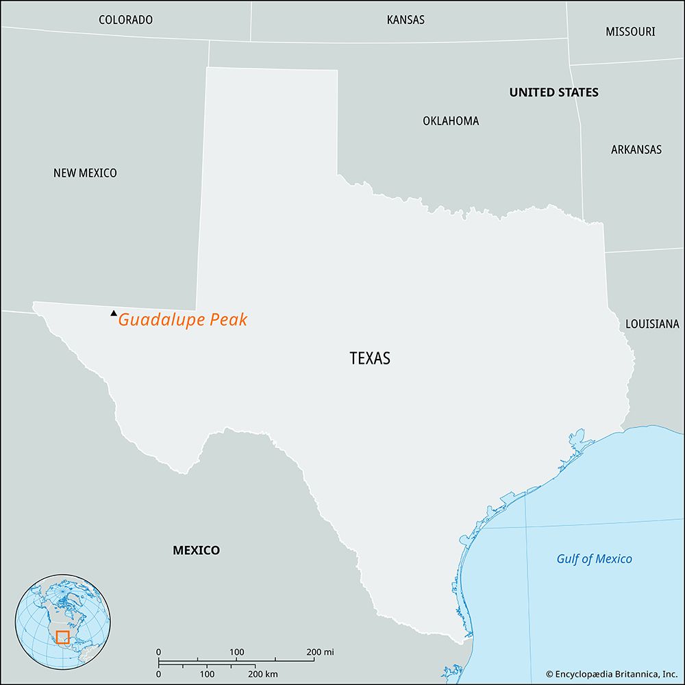
Guadalupe Peak is the highest point in Texas, reaching an elevation of 8,749 feet (2,667 meters). Located in Culberson County, approximately 100 miles east of El Paso, the peak is a prominent feature of the Guadalupe Mountains.12
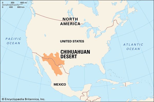
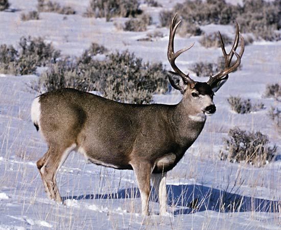
Together with its twin, El Capitan, the peak serves as a focal point of Guadalupe Mountains National Park. This region is characterized by an uplifted, ancient marine limestone reef that formed roughly 250 million years ago within what is now the Chihuahuan Desert. The park’s diverse landscape transitions from desert environments to high-country forests, supporting a variety of wildlife including mule deer, elk, and various bird species.12
How did the ancient Capitan Reef form the Guadalupe Mountains?
The Guadalupe Mountains were formed from the ancient, horseshoe-shaped Capitan Reef, which developed approximately 250 million years ago during the Middle Permian Epoch. Unlike modern coral reefs, this massive structure was primarily built by sponges, algae, and microbial organisms, with additional stabilization provided by bryozoans and brachiopods.23
The reef grew along the margins of the Delaware Basin, separating shallow-water platform environments from deepwater basin deposits. Over time, this reef accumulated about 600 meters (nearly 2,000 feet) of limestone. Following its formation, the reef was buried by layers of sediment.32
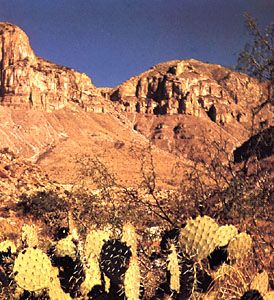
The modern mountains exist because portions of this buried, resistant reefal limestone were later uplifted. Because these limestone deposits are more resistant to erosion than the surrounding materials, they now stand as a prominent, high-elevation rim around the former basin. This geological history is clearly visible today in Guadalupe Mountains National Park, where the exposed reef forms striking features such as the massive promontory of El Capitan and the summit of Guadalupe Peak.23
What makes the Chihuahuan Desert environment unique?
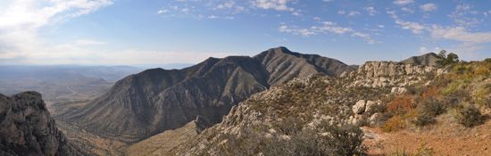
The Chihuahuan Desert is the largest desert in North America, spanning approximately 200,000 square miles across the United States and Mexico. Its uniqueness stems from its exceptional biodiversity and complex topography.78
Key Environmental Features
- Topographic Diversity: Unlike many flat deserts, the Chihuahuan features a varied landscape of mountains, valleys, plateaus, and lowlands. This elevation range creates diverse microclimates that support a wide array of life.8
- Biological Richness: It is one of the most biologically diverse deserts globally, home to over 3,500 plant species—1,000 of which are endemic. It hosts nearly one-fourth of the world’s cacti and supports a surprising variety of freshwater fish in isolated springs.8
- Rain-Shadow Effect: As a rain-shadow desert, it is blocked from moisture by major mountain ranges like the Sierra Madre, resulting in an arid climate with seasonal, often erratic, rainfall.89
While the region faces significant pressure from urban sprawl and water diversion, ongoing conservation efforts aim to protect its fragile ecological balance and endangered species.8
How does the plant life change from the desert floor to the mountain peaks?
The transition from the desert floor to mountain peaks creates a distinct shift in plant life, primarily driven by changes in elevation, temperature, and moisture availability.
Desert Floor
The lower elevations of the Chihuahuan Desert are characterized by arid-adapted vegetation. This environment features a variety of cacti, such as the prickly pear, alongside yuccas, agaves, sotols, bear grass, ocotillo, and creosote bush. These plants are typically xerophytes, evolved to survive with minimal precipitation and high summer temperatures.2108
Transition and Highland Forests
As elevation increases, particularly within the canyons of mountain ranges like the Guadalupe Mountains, the environment becomes cooler and receives more moisture. This change allows for a transition from desert scrub to more complex highland forests. In these higher, more temperate zones, the vegetation shifts to include forests of ponderosa pine, aspen, and Douglas fir.210
This ecological gradient demonstrates how plant communities become more complex as environmental conditions—specifically moisture and temperature—improve with altitude.8
Sources
- Guadalupe Peak — Encyclopædia Britannica
- Guadalupe Mountains National Park — Encyclopædia Britannica
- Permian Basin — Encyclopædia Britannica
- coral reef - Origin and development of reefs — Encyclopædia Britannica
- coral reef - Sedimentation — Encyclopædia Britannica
- Salado Formation — Encyclopædia Britannica
- Chihuahuan Desert: Top Questions — Encyclopædia Britannica
- Chihuahuan Desert — Encyclopædia Britannica
- North American Desert - Climate — Encyclopædia Britannica
- Conifer - Sporophyte phase — Encyclopædia Britannica
- North America - The Western sclerophyllous scrub forest — Encyclopædia Britannica
- North American Desert - Plant life — Encyclopædia Britannica
Published on · 3 min read