How Was the Grand Canyon Formed?
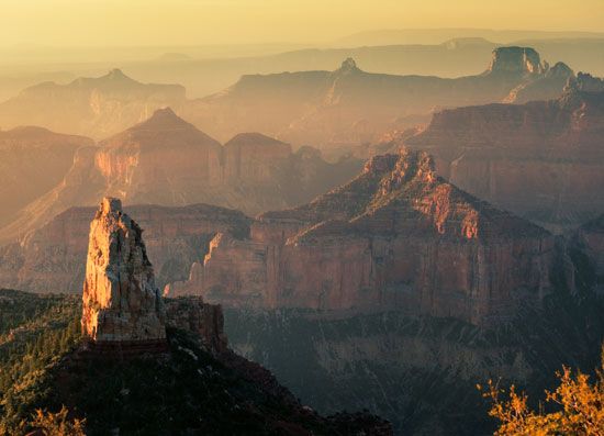
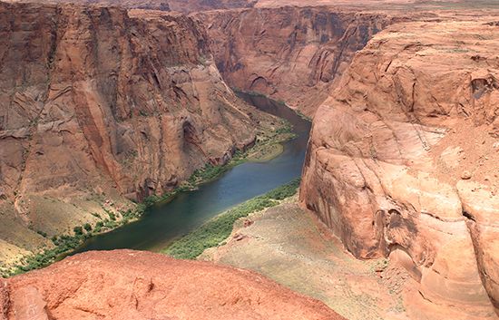
The Grand Canyon was primarily formed by the erosive power of the Colorado River, which began carving its path through the Colorado Plateau approximately six…
How was the Grand Canyon formed?
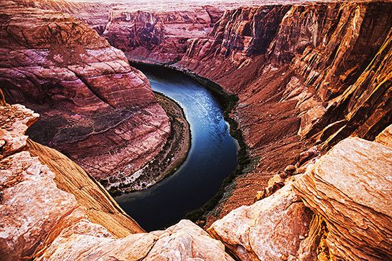
The Grand Canyon was primarily formed by the erosive power of the Colorado River, which began carving its path through the Colorado Plateau approximately six million years ago.12
The river’s ability to cut deep into the earth was driven by its rapid velocity and the massive load of sediment—averaging 500,000 tons per day before the construction of the Glen Canyon Dam—that it carried downstream. This process was significantly enhanced by the uplift of the Colorado Plateau, which steepened the river’s gradient and allowed for deep entrenchment.12
While the river is responsible for the canyon’s depth, its vast width is the result of other natural forces, including rain, wind, temperature fluctuations, and chemical erosion. The region’s semiarid climate is essential; without it, slope wash from rainfall would have eroded the walls and destroyed the canyon’s distinctive, stair-step topography.12
What is the Colorado Plateau and how did it rise?
The Colorado Plateau is a vast physiographic province in the southwestern United States, covering approximately 130,000 square miles across parts of Utah, Colorado, New Mexico, and Arizona. It is characterized by high elevations, deep river-carved gorges, and a landscape featuring mesas, buttes, and basins.5
How the Plateau Rose
The elevation of the Colorado Plateau is primarily the result of thermal expansion of the underlying lithosphere. During the late Cenozoic Era (beginning about 66 million years ago), an upwelling of hot material from the asthenosphere heated the lithosphere beneath the region. This warming caused the mantle to expand, which pushed the overlying surface upward to its current high elevation.1
Unlike many other high plateaus formed by crustal shortening or massive volcanic outpourings, the Colorado Plateau has remained remarkably stable and undeformed since the Precambrian time. This stability allowed the resistant Paleozoic limestone and sandstone layers to remain largely flat, creating the distinct, level horizons visible today. This uplift was a critical geological event that steepened the gradients of local rivers, enabling the Colorado River to carve deep features like the Grand Canyon.167
How do geologists determine the age of rock layers?
Geologists determine the age of rock layers using two primary approaches: relative dating and absolute dating. These methods allow scientists to reconstruct Earth’s history by establishing both the sequence of events and their specific timing.89
Relative Dating
Relative dating determines the chronological order of rock units without assigning a specific numerical age. This relies on logical principles and visual observations:1011
- Law of Superposition: In an undisturbed sequence of sedimentary rock, each layer is older than the one above it and younger than the one below it.1211
- Crosscutting Relationships: Any geologic feature—such as a dike, fault, or magma intrusion—that cuts across existing rock layers must be younger than the layers it disrupts.11
- Index Fossils: Distinctive, widespread, and short-lived fossils help geologists correlate rock strata across different geographic locations, providing a relative timeframe for the layers in which they are found.139
Absolute Dating
Absolute dating, or geochronology, provides a numerical age by measuring the decay of radioactive isotopes within minerals.148
- Radiometric Dating: Scientists measure the ratio of “parent” radioactive atoms to “daughter” stable atoms. Because these isotopes decay at a constant, known half-life, the ratio reveals how much time has passed since the mineral formed.14
- Precision: Techniques such as uranium-lead dating are highly precise and are used to calibrate the fossil record, allowing geologists to assign specific dates to the boundaries of the geologic time scale.14109
What are some other famous canyons formed by rivers?
While the Grand Canyon is perhaps the most famous example, many other spectacular canyons have been carved by rivers worldwide, often in response to tectonic uplift.1617
Notable examples include:
- Kāli Gandaki River Valley: Located in Nepal between the Himalayan peaks of Dhaulāgiri and Annapūrna, this is considered the world’s deepest subaerial valley, with a total relief of approximately six kilometres.17
- Copper Canyon (Barrancas del Cobre): A region in the Sierra Madre Occidental of northwestern Mexico, this area comprises a complex system of numerous deep canyons.18
- United States Canyons: Beyond the Colorado River, significant canyons in the U.S. include those carved by the Snake River, the Arkansas River, the Rio Grande, and the Yellowstone River.19
- Allegheny Plateau Canyons: Uplift in the eastern United States has created deep, narrow valleys throughout West Virginia and western Pennsylvania.16
Additionally, there are massive submarine canyons that rival the scale of the Grand Canyon, such as the Monterey Canyon off the coast of California and the Zhemchug Canyon in the Bering Sea.19
Sources
- How was the Grand Canyon formed? — Encyclopædia Britannica
- Grand Canyon - Geologic history — Encyclopædia Britannica
- Grand Canyon Series — Encyclopædia Britannica
- North America - 30 to 2.5 million years ago — Encyclopædia Britannica
- Colorado Plateau — Encyclopædia Britannica
- plateau - Formative processes — Encyclopædia Britannica
- Tertiary Period - Volcanism and orogenesis — Encyclopædia Britannica
- dating: Top Questions — Encyclopædia Britannica
- index fossil — Encyclopædia Britannica
- dating - Distinctions between relative-age and absolute-age measurements — Encyclopædia Britannica
- law of superposition — Encyclopædia Britannica
- geologic history of Earth - Time scales — Encyclopædia Britannica
- geologic time — Encyclopædia Britannica
- dating - Determination of sequence — Encyclopædia Britannica
- law of superposition — Merriam-Webster
- river - Formation of canyons and gorges — Encyclopædia Britannica
- valley — Encyclopædia Britannica
- canyon — Encyclopædia Britannica
- Copper Canyon — Merriam-Webster
Published on · 3 min read