Uralian Orogenic Belt
The Uralian orogenic belt is a significantly older mountain system compared to many of the world's prominent ranges, such as the Himalayas, which began…
How does the Uralian orogenic belt compare to other major mountain ranges in terms of age and formation?
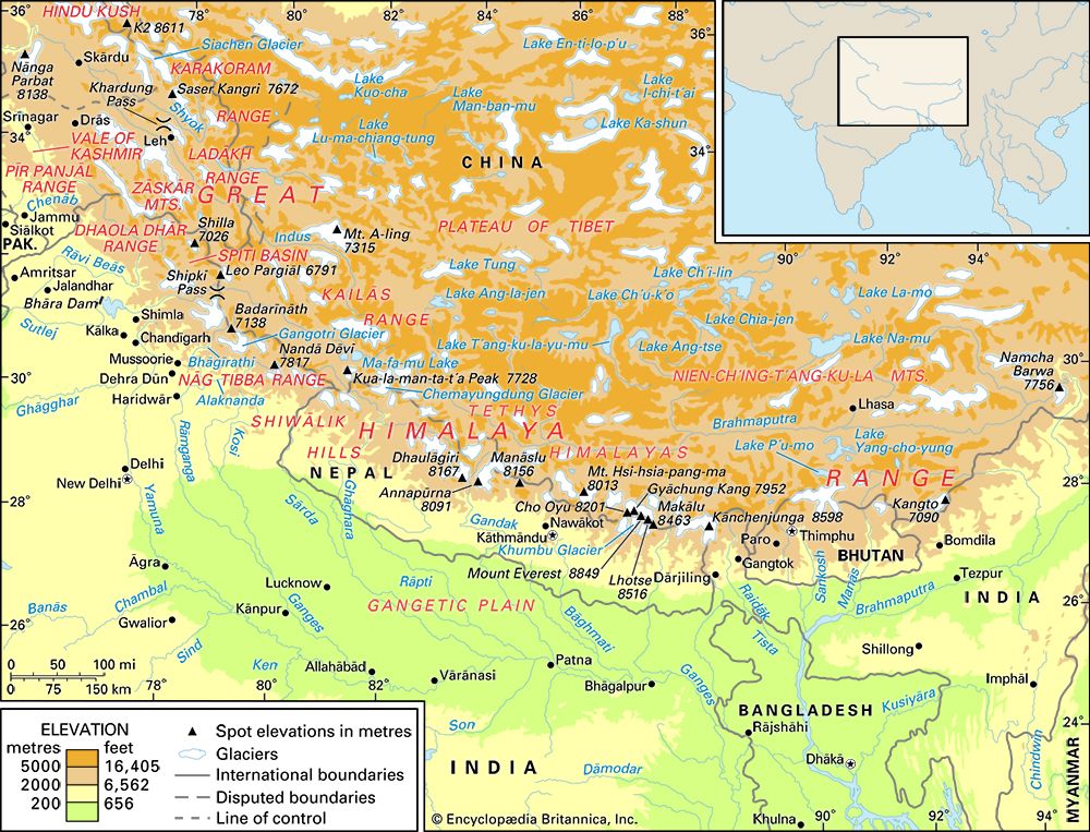
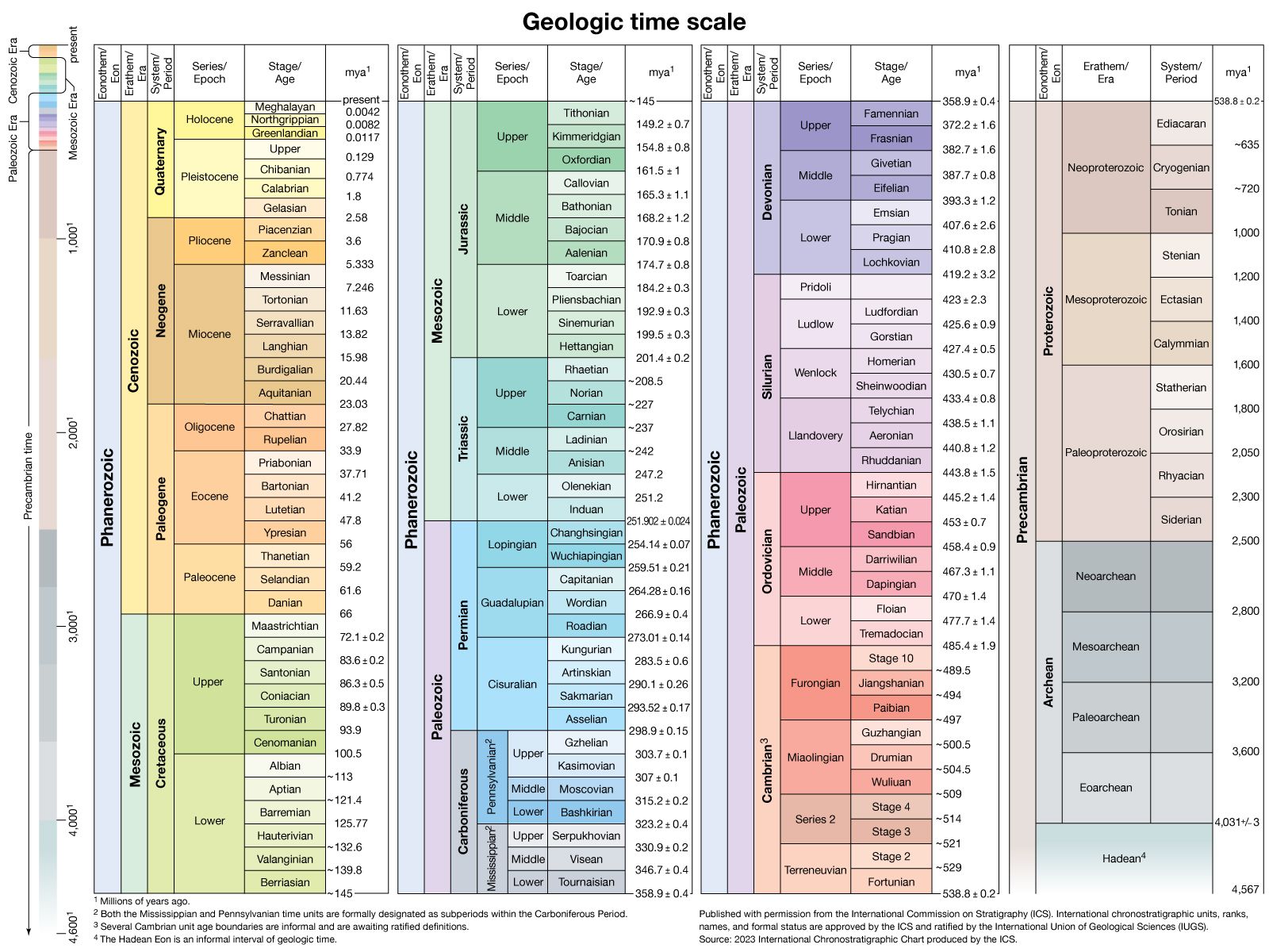
The Uralian orogenic belt is a significantly older mountain system compared to many of the world’s prominent ranges, such as the Himalayas, which began rising approximately 50 million years ago. In contrast, the Urals developed late in the Paleozoic Era, with final compression occurring during the Permian Period and Early Triassic Epoch, roughly 250 to 300 million years ago.123
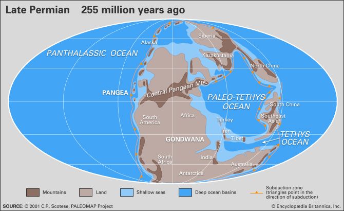
The formation of the Urals resulted from the collision between the continents of Europe and Asia, which closed the ancient Uralian Sea. This process involved the subduction of oceanic crust and the thrusting of ophiolitic slabs onto continental margins. Because of their great age, the Urals are classified as residual mountains. While they were once a high mountainous region, they have been subjected to hundreds of millions of years of erosion, leaving them as a lower-elevation chain compared to younger, tectonically active ranges. They share this characteristic of being an ancient, eroded collisional belt with the Appalachian Mountains in North America.24531
What is the Uralian orogenic belt and where is it located?
The Uralian orogenic belt is a massive, 3,500-kilometre (2,175-mile) long mountain system that serves as a traditional physiographic boundary between Europe and Asia.
The belt stretches from the Aral Sea in the south to the Novaya Zemlya archipelago in the Arctic Ocean in the north. It encompasses several distinct geographical features, including:123
- The Mughalzhar Hills in northwestern Kazakhstan.23
- The Ural Mountains proper, which extend roughly 1,550 miles (2,500 km) through west-central Russia0 km) through west-central Russia.23
- The Pay-Khoy Ridge, a northern extension leading toward the Arctic.23
The belt formed during the late Paleozoic Era due to the collision of the European and Asian continents, which closed the ancient Uralian Sea. This tectonic activity resulted in the thrusting of oceanic crust (ophiolites) onto continental margins, creating a region now known for significant mineral deposits, including chromite, platinum, and gold.13
How and when was the Uralian orogenic belt formed?
The Uralian orogenic belt formed during the late Paleozoic Era through a complex series of tectonic events. The process began approximately 500 million years ago with the rifting of Precambrian basement rocks, which eventually created the floor of the ancient Uralian Sea.
During the Silurian Period, island arcs developed, and subsequent subduction of the oceanic floor led to the thrusting of ophiolitic slabs onto continental margins. Significant thrusting and metamorphism occurred throughout the Devonian Period as the ocean floor was consumed. The final mountain-building phase resulted from the collision between the continents of Europe and Asia, which closed the sea. This final compression took place during the Permian Period (roughly 299 to 251 million years ago) and the Early Triassic Epoch (251 to 245 million years ago). Following this, post-orogenic extensional collapse contributed to the uplift and exposure of high-pressure rocks.13
How has the Uralian orogenic belt affected the climate and ecosystems of the surrounding regions?
The Uralian orogenic belt exerts a significant influence on the climate and ecosystems of the surrounding regions by acting as a physical barrier that affects moisture distribution and temperature patterns across the Eurasian landmass.28
Climate Influence
Despite their relatively low elevation, the mountains significantly impact regional weather. Prevailing westerly winds bring moisture from the Atlantic Ocean, resulting in higher precipitation on the western slopes compared to the eastern slopes. This creates a distinct climatic divide:8
- Western Slopes: Experience more humid conditions, with heavy precipitation supporting lush vegetation.89
- Eastern Slopes: Are notably drier and colder, often chilled by the powerful Siberian anticyclone during winter.8
Ecosystems and Biodiversity
The belt cuts across diverse latitudinal zones, creating a transition from Arctic tundra in the north to semidesert in the south. The varied climate fosters distinct ecological zones:29
- Forests: The western foothills feature broad-leaved forests (oak, linden, elm), while the eastern slopes are dominated by pine and larch. Further north, the landscape transitions into boreal forest (taiga) and eventually mountain tundra.9
- Fauna: Wildlife is largely representative of adjacent European and Siberian regions, including brown bears, lynx, and various fur-bearing animals like sable.10
Sources
- Uralian orogenic belt — Encyclopædia Britannica
- Ural Mountains — Encyclopædia Britannica
- Europe - Uralian orogenic belt — Encyclopædia Britannica
- Ural Mountains - Geology — Encyclopædia Britannica
- Ural Mountains — Merriam-Webster
- mountain - Geomorphic characteristics — Encyclopædia Britannica
- paleogeography - Mountain ranges — Encyclopædia Britannica
- Ural Mountains - Climate of the Ural Mountains — Encyclopædia Britannica
- Ural Mountains - Plant life — Encyclopædia Britannica
- West Siberian Plain — Encyclopædia Britannica
- Ural Mountains - Animal life — Encyclopædia Britannica
Published on · 3 min read