Which Waters Do You Pass Through When You “Sail the Seven Seas”?
The phrase "sailing the seven seas" does not refer to a single, fixed set of waters. Historically, the number seven was often used symbolically to mean…
Which Waters Do You Pass Through When You “Sail the Seven Seas”?
The phrase “sailing the seven seas” does not refer to a single, fixed set of waters. Historically, the number seven was often used symbolically to mean “many” rather than a literal count. Consequently, the definition has shifted across cultures and eras:1
- Ancient Greeks: Included the Aegean, Adriatic, Mediterranean, Black, Red, and Caspian seas, along with the Persian Gulf.1
- Medieval Europeans: Included the Atlantic Ocean and the Arabian, Baltic, Black, Mediterranean, North, and Red seas.1
- Age of Exploration: Used the four traditional oceans—Atlantic, Pacific, Indian, and Arctic—plus the Mediterranean, Caribbean, and the Gulf of Mexico.1
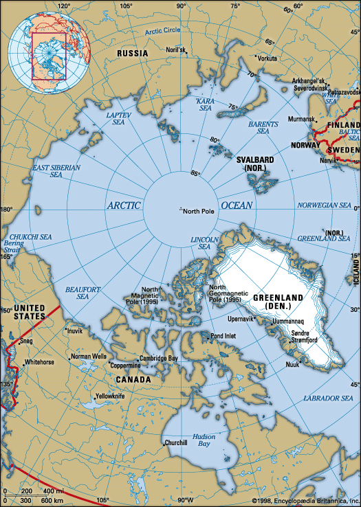
- Modern Interpretation: Often refers to the North and South Atlantic, North and South Pacific, Indian, Arctic, and Southern oceans, Arctic, and Southern oceans.1
Why is the number seven often used symbolically in history?
The number seven has held a profound symbolic status throughout history, often viewed as a bridge between the spiritual and the material. This significance is frequently attributed to the sum of the “spiritual” 3 and the “material” 4.4
Its mystique is bolstered by its mathematical properties; as a prime number, it cannot be formed by multiplying smaller integers, which has historically granted it a unique status in various traditions. Culturally, the number is deeply embedded in our perception of time and the cosmos:4
- Celestial Observation: Ancient cultures identified seven “wandering bodies” (the Sun, Moon, Mercury, Venus, Mars, Jupiter, and Saturn), which led to the establishment of the seven-day week.45
- Natural Cycles: The phases of the Moon last approximately seven days, influencing biological and cultural markers, such as the stages of human life in Chinese tradition.4
- Religious and Mythological Significance: From the seven candles of the Jewish menorah to the seven paths to heaven in ancient Egypt and the seven deadly sins in Christianity, the number frequently organizes spiritual hierarchies and moral frameworks.4
What are the main differences between a sea and an ocean?
The primary differences between an ocean and a sea are their size, depth, and geographical boundaries.
- Size and Depth: Oceans are vast, deep bodies of saltwater that cover approximately 71% of the Earth’s surface, with an average depth of about 3,688 meters (12,100 feet). Seas are significantly smaller and shallower than oceans.8
- Boundaries: Oceans are continuous expanses of water that are not confined by land. In contrast, seas are often located on the margins of oceans and are frequently partially enclosed by land, such as the Mediterranean Sea, which is bordered by Europe, Asia, and Africa.8
- Human Influence: Because of their proximity to land, seas are generally more accessible and are often more heavily influenced by human activities, carrying greater historical, political, and ecological significance compared to the open ocean.8
While the terms are sometimes used interchangeably in casual conversation, these geographical distinctions remain the standard for classification.89
How did ancient mariners navigate before modern technology?
Before the advent of modern technology, ancient mariners relied on a combination of observation, experience, and traditional tools to navigate the open seas.
Visual and Environmental Cues
Early navigators practiced piloting, which involved steering between ports by recognizing sequences of landmarks along the coast. When venturing into the open ocean, they relied on:13
- Celestial Bodies: Mariners used the Sun and stars to determine direction. In the Northern Hemisphere, the apparent rotation of stars around the Pole Star provided a reliable guide.14
- Meteorological Clues: Sailors observed steady winds and used them to maintain their course. This led to the development of the wind rose, which organized directions based on prevailing wind patterns.14
- Latitude Measurements: By measuring the elevation angle of the polestar or the noonday Sun using instruments like the quadrant, astrolabe, and cross-staff, navigators could determine their north-south position.15
Dead Reckoning
Navigators also employed dead reckoning, a method of estimating a ship’s position based on its known starting point, the distance traveled (estimated from speed), and the direction steered, while accounting for drift caused by wind and currents.1617
The Magnetic Compass
By the 12th and 13th centuries, the magnetic compass became a vital tool. Initially consisting of a magnetized needle floating on water, it evolved to include a compass card marked with a wind rose, allowing sailors to read their heading directly.18
Sources
- Which Waters Do You Pass Through When You “Sail the Seven Seas”? — Encyclopædia Britannica
- seven seas — Merriam-Webster
- seven seas — Merriam-Webster
- number symbolism - 7 — Encyclopædia Britannica
- Etymologies for Every Day of the Week | Sunday — Merriam-Webster
- number symbolism - 17 — Encyclopædia Britannica
- number symbolism - 8 — Encyclopædia Britannica
- Ocean vs. Sea: What’s the Difference? — Encyclopædia Britannica
- ocean — Merriam-Webster
- sea — Merriam-Webster
- sea — Merriam-Webster
- inland water — Merriam-Webster
- navigation - The lodestone and the compass card — Encyclopædia Britannica
- dead reckoning — Encyclopædia Britannica
- dead reckoning — Merriam-Webster
- navigation - Direction finding — Encyclopædia Britannica
- navigation - Latitude measurements — Encyclopædia Britannica
- navigation - Development of marine navigation — Encyclopædia Britannica
- navigation - Sailing instructions — Encyclopædia Britannica
- celestial navigation — Merriam-Webster
- Polynesian culture - Contemporary Polynesia — Encyclopædia Britannica
Published on · 3 min read