Zillertal Alps
The Zillertal Alps are a segment of the Eastern Alps situated along the border between Austria and Italy. The range extends northeastward for approximately…
What is Zillertal Alps?
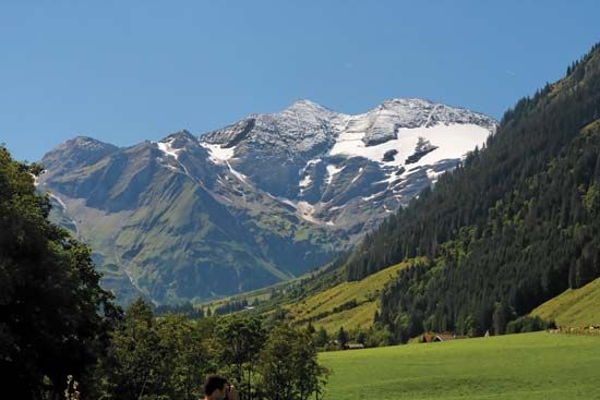
The Zillertal Alps are a segment of the Eastern Alps situated along the border between Austria and Italy. The range extends northeastward for approximately 35 miles (56 km), stretching from the Brenner Pass and the Ötztal Alps to the Hohe Tauern range.1
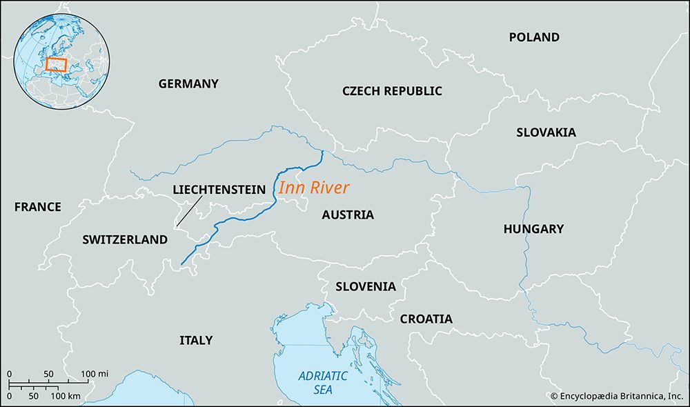
The geography of the region is characterized by snow- and glacier-covered peaks, with the Hochfeiler serving as the highest point at 11,516 feet (3,510 metres). The Ziller River originates within these mountains and flows northward to join the Inn River. Today, the area is primarily utilized for tourism and winter sports, which serve as the main economic activities for the region.1
How do glaciers shape the landscape of the Alps?
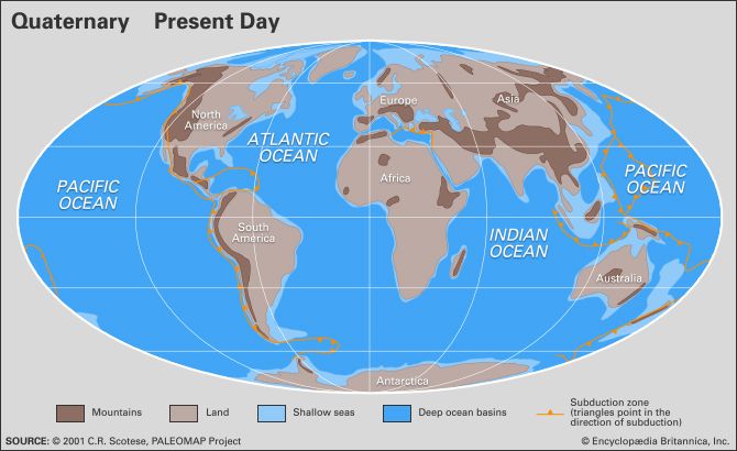
During the Quaternary Period, the landscape of the Alps was dramatically reshaped by glaciation. As massive ice tongues filled valleys and expanded onto surrounding plains, they acted as powerful erosive agents that carved the region’s iconic topography.67
Key landscape features formed by these glacial processes include:
- U-Shaped Valleys: Glaciers widened and deepened existing V-shaped river valleys, creating characteristic parabolic or U-shaped cross profiles with flat bottoms and steep, vertical sidewalls.68
- Cirques and Horns: Amphitheatre-like hollows known as cirques were scoured into mountainsides. Where multiple cirques eroded a mountain from different directions, they left behind sharp, jagged peaks called horns, such as the Matterhorn.68
- Arêtes and Tarns: The narrow, knife-edge ridges between parallel glacial valleys are known as arêtes. Deep basins scoured into the bedrock of cirques often filled with water to form tarns8.
- Depositional Features: As glaciers melted, they left behind vast quantities of sand, gravel, and morainic deposits, which contributed to more fertile soils in the valleys.67
What are the main differences between the Eastern and Western Alps?
The Alps are divided into distinct segments, with the Western and Eastern Alps exhibiting significant differences in elevation, geology, and drainage patterns.
Geographic and Structural Differences
- Elevation: The highest peaks are concentrated in the west. The Western Alps feature the range’s highest point, Mont Blanc (15,771 feet), and other massive crystalline peaks. In contrast, the Eastern Alps generally have lower elevations; for example, the highest peak in Austria, the Grossglockner, reaches 12,460 feet, while the Zugspitze in Germany and Triglav in Slovenia are even lower.5
- Geology: The Western Alps are characterized by autochthonous crystalline rocks forming massive chains. While crystalline rocks are also present in the east, the Eastern Alps encompass a wider variety of ranges, including the Dolomite Alps and the Julian Alps.5
Drainage Patterns
- Western Alps: Rivers in this region flow primarily west into the Rhône or east into the Po.5
- Eastern Alps: These ranges exhibit a more complex drainage pattern, generally trending north and southeast. Many rivers, such as the Inn, Salzach, and Enns, flow into the Danube, while others in Italy drain into the Gulf of Venice.5
How does tourism impact the environment in mountain regions?
The rise of mass tourism since World War II has significantly altered the environment of mountain regions like the Alps. While tourism has provided essential economic growth and employment, it has also led to the steady degradation of fragile ecosystems.312
Human impact on these environments includes:
- Landscape Transformation: The construction of ski slopes, roads, and infrastructure has caused significant slope erosion and the conversion of valleys into urbanized areas of concrete and asphalt.12
- Pollution: Increased human activity has resulted in water pollution, noise, and air pollution, the latter often trapped in valleys by temperature inversions. Furthermore, atmospheric pollutants concentrate in snow, releasing a pulse of contaminants into the ecosystem during the annual melt.1213
- Ecological Disturbance: High-mountain vegetation is highly sensitive to physical disturbance. Activities like skiing and intensive grazing can cause permanent damage to these low-nutrient, stressful habitats, which struggle to recover from such impacts.13
Sources
- Zillertal Alps — Encyclopædia Britannica
- Bavarian Alps — Encyclopædia Britannica
- Alps - Tourism — Encyclopædia Britannica
- Grossglockner — Encyclopædia Britannica
- Alps - Physiography — Encyclopædia Britannica
- Alps - Geology — Encyclopædia Britannica
- Pleistocene Epoch - Glaciation — Encyclopædia Britannica
- glacial landform - Cirques , tarns, U-shaped valleys, arêtes, and horns — Encyclopædia Britannica
- Carpathian Mountains — Encyclopædia Britannica
- Alps — Encyclopædia Britannica
- Alps - Settlement — Encyclopædia Britannica
- Alps - Human impact on the Alpine environment — Encyclopædia Britannica
- Mountain ecosystem - Biological productivity — Encyclopædia Britannica
Published on · 3 min read