Sarykol Range
The Sarykol Range is a mountain range situated along the border between the Gorno-Badakhshan province of Tajikistan and the People's Republic of China.…
What is Sarykol Range?
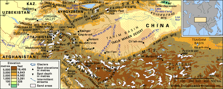
The Sarykol Range is a mountain range situated along the border between the Gorno-Badakhshan province of Tajikistan and the People’s Republic of China. Located in the eastern Pamirs, it runs parallel to the Kashgar Range and stretches approximately 215 miles (350 km) from the Markansu River valley to the Beik Pass.1
The range maintains an average elevation of about 16,500 feet (5,000 meters), with its highest peak, Mount Lyavirdyr, reaching 20,837 feet (6,351 meters). Geologically, the mountains consist primarily of schists, with granites found in the north and gneisses in the south. Serving as a vital watershed for the Amu Darya and Tarim River basins, the region is characterized by high mountain-desert vegetation and minimal glaciation.1
How do the Pamir Mountains influence the region’s climate?
The Pamir Mountains exert a profound influence on the climate of Central Asia, creating a sharp, continental environment that varies significantly with altitude and topography.
Climatic Drivers and Patterns
- Topographic Barriers: The mountains act as a massive physical barrier. Moist air masses moving from the west are forced up the valleys, where they encounter lower temperatures and produce locally heavy precipitation, often resulting in significant annual snowfall of 30 to 60 inches in certain highland areas.2
- Regional Winds: Weather patterns are heavily influenced by the “Afghan winds.” These winds originate in northwestern Afghanistan, intensify as they pass over the horseshoe ridges of the lower Pamirs, and bring summer dust storms followed by rain to the western mountains.3
- Temperature Extremes: The region experiences extreme temperature fluctuations. In the high eastern Pamirs, such as at Murghob, winter temperatures can plummet below −58 °F (−50 °C), while the lower western valleys experience milder, though still continental, conditions.32
Regional Variations
The climate is generally divided by the range’s complex relief:
- Western Pamirs: Characterized by deep, narrow ravines and high-mountain ridges, this area receives substantial snowfall, which supports extensive glaciation.34
- Eastern Pamirs: This area features a high, arid plateau where precipitation is very slight—often only 2 to 3 inches annually—with most of it occurring during the summer months.32
What are the main differences between the Amu Darya and Tarim River basins?
The Amu Darya and Tarim River basins are both vital interior drainage systems in Central Asia, yet they differ significantly in their geography, hydrology, and environmental status.
Geographic and Hydrological Differences
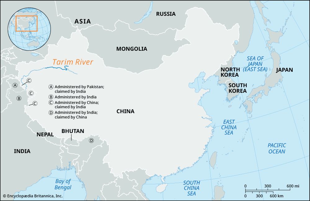
- Location and Scope: The Amu Darya flows northwest across the Turan Plain, forming borders between Afghanistan, Tajikistan, Uzbekistan, and Turkmenistan. In contrast, the Tarim River is located in the Xinjiang region of western China, flowing through the Takla Makan Desert within a vast depression enclosed by the Tien Shan, Kunlun, and Pamir mountains.789
- Water Sources: Both rivers rely on mountain snowmelt and glaciers. However, the Amu Darya is fed by the Vakhsh and Panj rivers, while the Tarim is formed by the confluence of the Kashgar and Yarkand rivers, with the Aksu River providing the majority of its volume.79
Environmental Challenges
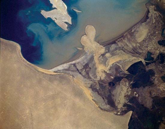
- Irrigation and Desiccation: Both basins have suffered from extensive water diversion for agriculture. The Amu Darya’s diversion historically fed the Aral Sea, which has shrunk drastically, leading to severe ecological damage and soil salinization. Similarly, the Tarim River’s lower course was dried up by mid-20th-century irrigation projects, turning the former terminus of Lop Nur into a salt-encrusted lake bed, though recent efforts have aimed to restore some flow.7109
- Climate: The Tarim Basin is considered the driest region of Eurasia, with some areas receiving as little as 0.5 inches of annual precipitation, whereas the Amu Darya basin experiences more varied conditions, ranging from high-mountain moisture to arid lowland deserts.79
What kind of wildlife survives in high mountain-desert environments?
Wildlife in high mountain-desert environments consists of highly specialized species capable of surviving extreme temperature fluctuations, arid conditions, and low oxygen levels.
Mammalian Adaptations
Many animals in these regions have evolved specific physiological traits to thrive at high altitudes. Indigenous species like the yak possess a genetic adaptation that allows their blood to achieve full oxygen saturation at lower partial pressures, unlike humans who must rely on temporary acclimatization.14
Common inhabitants of these rugged terrains include:
- Wild Ungulates: The argali (Marco Polo) wild sheep, blue sheep, ibex, and markhor are well-adapted to navigating steep, craggy slopes. In more desolate plateau areas, one can find kiangs (wild asses) and wild yaks.15161718
- Predators: The snow leopard is the apex predator of these regions, though it remains rare due to habitat loss and hunting. Other predators include wolves, brown bears, and lynx.1516171819
- Small Mammals: Marmots, pikas, and various rodents are common; many of these species hibernate or cache food to survive the harsh winters.162019
Avian Life
High mountain-deserts support a variety of raptors that utilize mountain updrafts, including lammergeiers, Himalayan griffons, and golden eagles. Additionally, these regions serve as critical stopovers for migratory waterfowl traveling between Siberia and South Asia.16171815
Sources
- Sarykol Range — Encyclopædia Britannica
- Pamirs - Climate — Encyclopædia Britannica
- Tajikistan - Climate — Encyclopædia Britannica
- Pamirs — Encyclopædia Britannica
- Pamirs - Drainage — Encyclopædia Britannica
- Pamirs - Physiography — Encyclopædia Britannica
- Amu Darya — Encyclopædia Britannica
- Panj River — Encyclopædia Britannica
- Tarim Basin — Encyclopædia Britannica
- Tarim River — Encyclopædia Britannica
- Tigris-Euphrates river system: Top Questions — Encyclopædia Britannica
- Uzbekistan - Drainage — Encyclopædia Britannica
- Asia - Rivers — Encyclopædia Britannica
- Kunlun Mountains - Plant and animal life — Encyclopædia Britannica
- Pamirs - Animal life — Encyclopædia Britannica
- Pamirs - Plant life — Encyclopædia Britannica
- Tundra - Alpine mammals — Encyclopædia Britannica
- Karakum Desert - Plant and animal life — Encyclopædia Britannica
- Hindu Kush - Animal life — Encyclopædia Britannica
- Altai Mountains - Animal life — Encyclopædia Britannica
- human respiratory system - High altitudes — Encyclopædia Britannica
- climatic adaptation — Encyclopædia Britannica
- Karakoram Range - Plant and animal life — Encyclopædia Britannica
Published on · 4 min read